1

A
couple of years ago, after visiting 'Naneghat' cave located near a
pass in the 'Western Ghat mountain range' on west coast of India, I
had taken upon myself a task of visiting places that still carried
traces in some form or other, of the ancient Satvahana empire that
ruled the Deccan plateau for about 400 years beginning somewhere
before 200 BCE and up to at least 200 CE.
In my
quest, most of the places I visited, were Buddhist rock cut temples
excavated along the mountain faces of the 'Western Ghat mountain
ranges.' I have narrated my journeys to these places in great
details in my book
'Traces of an Empire'
and interested readers would be able to read this book, available on
the net. All these places except Naneghat cave, were thriving
Buddhist monasteries once, with hundreds or even thousands of monks
living there. It would be obvious to any one that such large human
settlements, even if they are strictly religious, can not run unless
there is substantial monetary support from some source or other.

The
Buddhist monks in those days ( as are even today) were supposed to
follow strict discipline and code of conduct. This code of conduct
was stipulated in an ancient text (still being followed at least in
letter) known as 'Vinaya.' This code of conduct stipulates firstly
that for monks, nuns and preachers of law any possession of
property is strictly forbidden. They were not allowed even a contact
with gold, silver, jewels and such precious commodities. Secondly
they were supposed to eat food that was given to them after begging
and they had to wear robes stitched by themselves from discarded
rags.
A
question
therefore
naturally comes to mind that with these kind of stipulations, how
could monasteries located on remote mountain slopes and housing
hundreds or even thousands of monks could survive, particularly in
the monsoon months when any contact with outside world was almost
impossible. One eminent scholar of yesteryear, Late Dr. D.D.Kosambi
has tried to give an explanation of this difficulty. He says and I
quote:
“ The
caves were· located where they are, because the trade-routes passed
by, and the larger complexes were invariably near the junctions of
such routes..... The main problem at the time the caves were first
carved out of the rock was to find the routes up the Western Ghat
mountain range to the Deccan plateau. ”
Thus
we can say with certainty that all major Budddhist rock cut temples
such as those at Karle'n, Bhaje, Shelarwadi, Bedse etc. were located
near the junctions of major trade routes and a vast number of small
caves were dug near minor trade routes. This raises another question
as to with whom the trade was being carried? Luckily records from
Gracco-Roman accounts such as those written by the Pariplus
and
Ptolemy clearly indicate that the trade was carried with Greece as
well as Rome and the goods arrived at the trade ports that lay on the
west coast of India. These trade posts were mostly up the creeks and
estuaries of rivers to the extent navigation permitted. Ports which
lay in the vicinity of these Buddhist caves in the Western Ghat
mountain ranges can be listed as Broach (Bhadoch) Sopara (Nala
Sopara), Kalyan and Choul.

Coming
back to the problem of sustenance of the Buddhist monks living at
these Monasteries, Late Dr. D.D.Kosambi, gives the example of Chinese
monasteries which were developed more or less on the lines of Indian
establishments. He says that:
“ The
documentary evidence exists at the other end of the Buddhist world,
in Chinese records and translations particularly from
cave-monasteries such as Tun Huan and Yuen Kang (Ta-tung) of the ways
in which Vinaya rules were modified by the cave monasteries without
deviating from the letters.
Thus
cave monasteries in India avoided Contact with gold, silver. Jewels
and such precious commodities by using an intermediary servant called
as “Upasaka” for the manipulation, or in extreme cases by
insulation with a piece of cloth! These two Orders further deposited
the bulk of' the donated wealth with the monastery treasurer, who not
only handled the gifts, permissibly used the money for repairs to the
dwellings, but directly contravened the original rules by using the
funds also for the purchase of necessities (such as food) that should
have been obtained by begging, and for the robes that should have
been pieced together from discarded rags. ”
It
should be now clear that the Buddhist monasteries in the Western Ghat
Mountain ranges largely depended, besides financial help received
from the King, on the donations and endowments received from the
wealthy in the society. This fact can be confirmed from the large
number of inscriptions that liter all the cave temples.

Regarding
assistance from the state or the king, it was mostly provided by
awarding or assigning a village to the monastery. No taxes were
collected from that village by the state and the entire yield from
that village was collected by the monastery. Thus we have Usavdatta,
who was son-in law of Satrap Nahapana, donating village of Karajaka
for the sustenance of the monks at Karle'n Monastery and later when
he was defeated by the great king Goutamiputra Satakarni, the new
ruler immediately confirmed the endowment. Both these deeds of
endowment can be still seen in inscriptions numbered 13 and 19 at the
Rock Cut temple at Karle'n.
However,
what I am more interested here are the individual donations by
wealthy citizens to the monastery. In the rock cut temples at Karle'n,
there are at least 37 inscriptions and most of them speak about grant of
some money to the monastery. But what is really surprising is the
fact that in at least 17 of the 37 inscriptions, name of a place
called “DHENUKAKATA” appears, saying that the donors were from
this place. In none of the other rock cut temples spread all over
Western Ghat Mountains, this name appears anywhere except at two
caves: one in Shelarwadi and the other in Kanheri (near Mumbai.) It
is obvious that people from Dhenukakata loved the Karle'n Monastery
much more than the others. But why did they liked only this
monastery? And neglected all others.
Secondly,
the most important riddle perhaps is the location of this mysterious
place Dhenukakata, where so many wealthy lived at the beginning of
our era.
Where
the hell was this place, Dhenukakata then?
2

(Main Chaitya hall at Karle'n caves, The supporting pillars have inscriptions indicating names of the donors)
To
continue with our quest for the mysterious town of Dhenukakata, it
might turn out to be a good idea to see if possible, who were the
people living there, who had generously contributed in the
construction of this Buddhist Monastery on a hill slope near present
day village of Karle'n. Incidently, as seen from the inscription
(No. 8) carved on the facade of the Chaitya by King Pulumavi, the
present village of Karle'n and the ancient Buddhist Monastery nearby,
were known as Valuraka Village and Valuraka Monastery.
These
are the donors from Dhenukakata:
A
carpenter, who calls him Sami and son of Venuvasa. He made the wooden
door to the cave and did it at his own expense.
A
Yawana (Greek) resident called Dhamma.
Another
Greek resident called as Simhadhwaja.
A
resident called Sommilanaka.
Mitadevanaka,
son of Usavdatta. (We have seen earlier that Usavdatta was son-in-law
of the Satrup Nahapana.) This means that grandson of the satrup, who
ruled most of the Deccan plateau at that time was a resident of
Dhenukakata.
Isalaka,
who is the son of a trader named as Gola
A
Greek resident named as Yasavadhana.
A
person who has been a good wife and either has a name as Mahamitaa or
whose grandmother is named here (Inscription is unreadable)
Dhammadevi-
granddaughter of a nobleman Asoka
A
physician named as milimdasa, his wife Jayamitaa, his sons Bhayabhuti
and Nabubuti and daughter Vasumitaa.
Utaramati,
wife of Drughmita.
A
Greek resident Kulaykhann.
Rohanmita
on behalf of his younger maternal uncle Agila.
A
Greek named as Dhamadhaya. (This inscription appears on a pillar,
capitol of which has a figure of Sphinx.)
Trader's
association (vaniya-gama) from Dhenukakata. (This might be one of the
earliest reference to a traders association or chamber)
Simhadata,
a perfume merchant from Dhenukakata

(Sculpture of a sphinx on the capitol of a pillar donated by a Greek.)
From
above descriptions, we can get a fair idea about the people, who
stayed in Dhenukakata. There must have been a number of Greek
traders, who must have settled here as we can see at least 5 Greek
donors here. Greeks were Roman citizens then. Would it mean that the
Dhenukakata was a Grecco-Roman settlement on west coast of India?
There are professionals too like a wealthy carpenter, a physician and
a perfume merchant. What is most surprising was the fact that there
was a trader's chamber in Dhenukakata, which indicates that it was
essentially a trading community.
We
shall turn to a bit of history here, to appreciate the significance
of one of the inscriptions mentioned above. Satavahana kings came
to sovereign power in the Deccan plateau only after demise of Emperor
Ashoka in the north, around 220 BCE. It is believed that they were
vassal kings under him earlier. After a stable rule of two centuries
or so, the political situation turned turbulent as a descendent of
Indo-Scythians, Nahapana, who always called himself a satrap, rose in
northeast in the first century CE and slowly captured major chunks of
Satavahana territories, including the ones surrounding the Karle'n
monastery. He had probably appointed his son-in-law Usavdatta as
Governor of the Satavahana territories. It is believed by some
historians that Bhadoch city in Gujarat was the capital of Scythian
Satraps.

(Sculpture on a capitol)
Where
Dhenukakata fits in all of this? The inscription mentioned above
tells us that one of the son of Governor Usavdatta, named as
Mitadevanaka was actually a resident of Dhenukakata, which shows that
it must have been an important town as the Governor had stationed his
own son there.
With
all these details, a picture emerges of a town: located on one of the
important land trade routes between the Deccan plateau of India and
the Grecian-Roman empires. The town had a large trading community,
who had their own association or a chamber in the town. Professionals
like Carpenter, physician and a perfume merchant reside in the city.
But why Karle'n monastery was so much important to the people of this
flourishing town and why they paid substantial amounts for upkeep
and beautification of this only monastery, even though there were at
least three more monasteries in the vicinity at Bhaje, Shelarwadi and
Bedse?

(Inscriptions on a pillar)
The
importance of monasteries in those days to the traders has been well
explained by Late Dr. D.D. Kosambi (whom I have quoted earlier) in
one of his articles; he argues:
“ It
is clear from the inscriptions and the Chinese Budddhist evidence,
that the intimate connection between the rich monastery at Karle'n
and the wealthy merchant settlement at Dhenukakata had a soild
economic foundation. The mercantile function of the monasteries was
not only the purchase of cloth and other commodities for the monks
and the retainers and the buying of the costlier materials for the
rituals and ostentation but also the supply (for profit) of essential
provisions and the loan (at interest) of indispensable capital to the
trade caravans. The great market centers of Satavahana empire were
sparsely distributed; their interconnecting trade routes passing
through wild, thinly settled and difficult country. The caves were
located conveniently near the worst stage of the journey. The
monasteries were untaxed and their possessions not in danger of
arbitrary confiscation by officials. ”

(Pillar with Hinayana Buddhism motifs and inscriptions)
In
other words, the monasteries (like the one at Karle'n), besides
providing a ready market for food, clothing and all other essentials
for the traders, were also a source of cheap funds for the traders
and a sanctuary from the taxmen as well as from brigands. It also
becomes very clear from these observations, as to why a close
relationship existed between the wealthy residents of the Dhenukakata
and the Karle'n monastery.
The
simple reason for this close relationship was that the prosperous
town of Dhenukakata looked upon the Karle'n Monastery not only as a
market for foodstuff and clothing but also a source of cheap funds
and a sanctuary. All this means only one thing, Dhenukakata was
located somewhere in the vicinity of the monastery at Karle'n and not
at a great distance from it. Also, for the state, the town was so
important that the Governor had appointed one of his own sons as in
charge of the town.
3
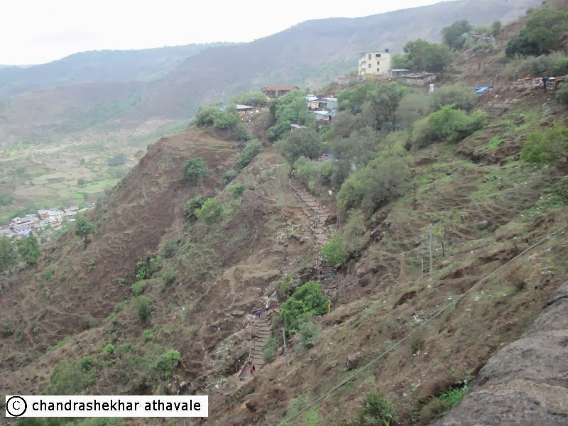
(View of Karle'n valley from the Monastery)
Before
we proceed further in our quest to locate Dhenukakata, which existed
at the beginning of our era, let us summarize what we already know
about this town. It was a prosperous trading community with many
Greek ( or Roman) traders settled in it. They even had a traders
association representing the traders. It was located on one of the
trade routes leading to empires of the Deccan and it was in the
vicinity of Karle'n monastery.
Based
on these facts, it may not be erroneous to come to a conclusion that
Dhenukakata traders probably handled the import-export trade mainly
that took place between Empire of the Deccan on one hand and
Greco-Roman empire on the other. This naturally brings up a question;
was the trade volume that possibly existed at that time between Rome
and Pratishthan (Today's Paithan), justifies the establishment of a
prosperous trading town that too just only on one of the possible
trade routes to the Deccan.

Gaius Plinius Secundus (CE 23 – CE 79), better known as Pliny the Elder ( a Roman author, naturalist, and natural philosopher, as well as naval and army commander of the early Roman Empire) has commented while remarking about the adverse balance of trade of the Roman empire: “This is the price we pay for our luxuries and our women. At the last reckoning one hundred million sesterces are taken away by India, Seres and Arabia.” Every year up to 40 ships carried luxury goods consisting of half the export trade of Rome between Rome and India. The imports from India included spices, pearls, muslin,ivory etc, while exports to India were very few and consisted mostly of wine, musical instruments, singing boys and dancing girls. The balance of trade was so adverse that Rome had to pay in Gold Bullion to India every year.
I have
specifically given these details here, just to highlight the fact
that trade volume with Rome was exceptionally high and fully
justifies existence of booming trading communities like Dhenukakata
on Indian soil. The next question that pops up is about the trade
routes that were in existence at that time. If we could know about
the trade routes, we might possiblly be able to locate trading
communities like Dhenukakata. To trace the trade routes, the better
idea would be to start from the sea ports from where obviously, the
ships left for Rome and also arrived with their wine casks.

Claudius
Ptolemy (CE 90 – CE 168) was a Greco-Roman writer of Alexandria,
known as a mathematician, astronomer, geographer, astrologer, and
poet. He was the author of several scientific treatises, at least
three of which were of continuing importance to later Islamic and
European science. 'The Geography' (also known as Geographia,
Cosmographia, or Geographike Hyphegesis) is Ptolemy's main work. It
is a treatise on cartography and a compilation of what was known
about the world's geography in the Roman Empire of the 2nd century.
Ptolemy
tells us that four major trading ports on India's west coast, carried
bulk of the cargo to and from Rome. These included (The names in
brackets are the names mentioned by Ptolemy), Bhadoch (Barygaza),
Dounga (Salsette island), Sopara near Bassein or Vasai ( Suppara) and
finally Choul or Chaul ( Semylla or Cemūla.) Taking these and
also Kalyan, which we know was a trading port, as starting points, it
should be easy to trace the routes up to the Deccan plateau as they
have to pass through one of the mountain passes in the Western Ghat
mountain range. Since the Buddhist monasteries were all located near
the trade routes, these trade routes also have to pass through the
vicinity of one of the monasteries.
Leaving
aside the trade route from Bhadoch, which is in any case was far off
from Karle'n monastery, the other trade routes must have started
either from Kalyan, Salsette or Sopara and or from Choul in the
south. Late Dr. D.D.Kosambi has outlined several such routes that
might have existed and I quote:
"The
northern feeder route starting from Kalyan, Sopara went right along
the foot of the western Ghats and reached Junnar town through
Naneghat. One possible route might have climbed up Sava or Kurvanda
pass near present town of Lonavala and would have passed in the
vicinity of Bedse monastery. .Another route came up the vally near
today's hill station Khandala and passed in the vicinity of Kondane
monastery. However all these routes were difficult and were not
popular."
One
more route existed in the south, which was most suitable for the port
of Choul or Chaul. This route climbed up the Ghat near Mulshi lake of
today (This is probably the same pass that is known as 'Tamhani Ghat'
today.) and passed on through Pavna valley in the vicinity of
Shelarwadi monastery and finally reached Bhaje and Karle'n
monasteries. From here the route skirted the hills past the foot of
Karle'n caves through Navlakh Umbar village, Chakan and then merge in
the route to Junnar town. This also perhaps explains a solitary
donation from a Dhenukakata resident to Shelarwadi Monastery.

I have
tried to trace these two major routes on a Google earth map and it
can be seen easily that the Naneghat route is much shorter for
reaching Junnar, which any way was the main centre for commerce
during those days. Any one would wonder then, why the route starting
from Choul and passing by the Karle'n monastery was taken by the
traders, when it was much longer and troublesome. It would have been
almost impossible to find an answer to this but for a short
explanation given again by another ancient Greek text “Periplus of
the Erythraean Sea.' This text was written between 1st
and 3rd
centuries CE and describes navigation and trading opportunities from
Roman Egyptian ports like Berenice along the coast of the Red Sea,
and others along Northeast Africa and the Indian subcontinent.

I have
mentioned above, that at the beginning of our era, the political
situation in the Deccan had become highly turbulent with Satrap
Nahapana's forces having captured major chunks of Satavahana empire
including the areas near Karle'n monastery. Nahapana's forces also
had gained control over coastal areas and the ports like Kalyan.
Periplus text confirms this situation and says:
“The
market-towns of this region are, in order, after Barygaza (Bhadoch):
Suppara, (Sopara)and the city of Calliena (Kalyan), which in the time
of the elder Saraganus (Satavahanas) became a lawful market-town; but
since it came into the possession of Sandares (Kshatraps or
Nahapana's forces), the port is much obstructed, and Greek ships
landing there may chance to be taken to Barygaza (Bhadoch) under
guard. Beyond Calliena there are other market-towns of this region;
Semylla (Chaul)..…”
A century later, Claudius Ptolemy again confirms the political
situation when he does not mention the Kalyan port ( now unsafe
because of the war like situation) at all, and mentions only
Souppara (Sopara) mouth of the River Goaris, Dounga (Salsette
island), mouth of the River Bêndas, and Semyla or Chaul.

(The trading ports and the Buddhist Monasteries of Satavahana period)
I
think the readers would now appreciate the situation in the first
century CE, when Greek or Roman ships were unable to load/ unload
their cargoes at 'Kalyan.' Sopara was to the north and inconvenient,
so they were forced to use southern ports like Salsette island and
Choul. This also made the shorter 'Naneghat' route to Junnar town no
longer preferable as it was much to the north of the port of lading,
Choul. The southern route from Chaul and through 'Tamhni' pass must
have become suddenly popular for this reason and with it grew the
importance of the largest monastery in the area, the one at Karle'n.
We
shall now try and see if we can locate the Trading boom town of
Dhenukakata, which was possibly situated somewhere on this trade
route.
4

(A temple in Chaul town)
Earlier,
we saw, how India's trade with Rome was affected, around the
beginning of our era, by the raging wars between Satavahana empire
and Indo-Scythian Kshatrapa, Nahapana's forces and how the ships
calling on Indian ports had to shift their port of call to Choul in
the south. This necessitated a new trade route up the Western Ghat
mountain range through the Pimpri ghat (Tamhini Ghat of present), to
the main commerce centre of that time, located in Junnar town. This
also meant that the trading boom town of Dhenukakata was located
somewhere along this route.

Let us
now examine the names of towns and places suggested by scholars and
historians and to what extent they fit with these specific details.
One of the first attempts was made JAS Burgess (Archaeological
surveyor and reporter to Government)
and Bhagwanlal Indraji Pandit in their book, “Inscriptions from
the cave -temples of western India, “ published in 1881 , where
they say that “ Dhenukokata was the old name of the village
Dharnikota located near Amarawathi town on the banks of Krishna river
in Andhra Pradesh state.”

This
identification has been however rejected by most historians for a
valid reason. In the first place, Amarawathi town in Andhra Pradesh
itself was a famous Buddhist pilgrimage center with a giant Stupa
erected there. In the vicinity, there was a large Buddhist Monastery.
In fact Xuan Zang, one of the most famous travelers of the ancient
world, who had made an epic journey from his native China to South
India and back, in the seventh century of our present era, had
visited this monastery on his way to Kanchipuram in south. Late D.D.
Kosambi therefore writes rightly:
“ There
is no apparent reason why people from Dharnikota, Greeks or not,
should march right across the peninsula and cross the whole
Satavahana kingdom to concentrate their donations at Karle'n.”
We
therefore should be able to reject this identification easily. Now we
move to another identification. In an article titled as “ Two
Notes on Ptolemy's Geography of India,' written in the “ Journal
of the Royal Asiatic Society” published in 1941, E.H. Johnson had
proposed that the port of Dounga that appears in Ptolemy's list, or
the modern day “Dongri” village on the Salsette island must be
the town of Dhenukakata.
I find
this identification as most exciting, because Salsette island is none
other than the present day city of Mumbai, which is considered as
commercial capital of India. The idea that even 2000 years back,
Mumbai was a large trading community, which included many Greeks, is
really heart warming. Unfortunately however, this identification
also can not stand true.
I
have mentioned before that the ancient Greek text “Periplus of the
Erythraean Sea.' says clearly that the city of Calliena (Kalyan),
which in the time of the elder Saraganus (Satavahanas) became a
lawful market-town; but since it came into the possession of
Sandares (Kshatraps or Nahapana's forces), the port is much
obstructed, and Greek ships landing there may chance to be taken to
Barygaza (Bhadoch) under guard. If the readers refer to the Google
earth images I have posted here, it should be clear that ports of
Kalyan and Salsette island are in the vicinity of each other and if
Kalyan port was not available for Greeek ships, it is unlikely that
Salsette island could have been available to them too. The entire
area around these ports must have been a hostile area in possession
of Nahapana's forces and no trading community, trading with
Satavahana empire could have existed there.
There
is one more point which goes against Salsette island's identification
as Dhenukakata. The shortest route to the commercial center at Junnar
from salsette is same as that from Kalyan; the one through Naneghat
mountain pass. In the vicinity of this route, there were two
monasteries. One at Kanheri and a big one near Junnar. In Junnar
caves, there is no mention of Dhenukakata any where at all, and in
Kanheri, Dhenukakata is mentioned in just one inscription. This
virtually rules out possibility of Salsette island or Mumbai being
identified as Dhenukakata.
The
above argument also rules out Dahanu ( a coastal village north of
Sopara) as a possible identification because any route from Dahanu to
Junnar had to pass through hostile areas near Kalyan and also
Naneghat mountain pass.
Some
researchers including Samoel Clark
Laeuchli ( Journal of the Asiatic Soceity of Bombay, Vol 56-59,
1981-84, pp.214) believe that the main commercial center of
the Satavahana empire on the west coast or Junnar town, could be
identified with Dhenukakata. The argument is that since in the nearby
Junnar Monastery inscriptions, Dhenukakata is not mentioned at all,
the town of Junnar must be Dhenukakata itself. According to him:
“Ptolemy mentions a place by the name of Omenogara which is close
to what he calls the Nanaguna river. Naneghat and Gunaghat are both
names of passes 25 km to the west of Junnar, and it seems very likely
that this Omenogara was indeed Junnar, On the basis of this fact it
bas been argued that the ancient name for Junnar was Minanagara, cf.
the Mina river which is close to Junnar. ”
In
the Karle'n inscription no.6 however, there is a mention of Yawana
Citasagata, who hails from Umehanakta, making a donation. Laeuchli
feels that this particular name is of Iranian origin and also means
Junnar. He asserts that the identification
Umehanakata=Omenogara=Junnar seems beyond doubt and eliminates the
consideration Junnar = Minanagara
It is difficult to accept this argument at all, as, if this one is accepted, we
would have had found names of Dhenukakata and Umehanakata donors in
all other nearby Monasteries such as those at Bhaje, Kondane, Bedse
and Shelarwadi. But that does not happen and these names occur only
in Karle'n monastery but for a solitary exception in Shelarwadi.
D.D.Kosambi
identifies Junnar with the city of “Tagar” mentioned by Ptolemy
and in the Periplus (McCrindle's Edition, 126). It was an important
commercial town with trade links not only with Bhadoch in the north
but also with Masulipatan on east coast of India besides Pratishthan
(Today's Paithan) that was the capital of the Satavahanas. However, Periplus clearly mentions that the city of Tagara is about 10 days walk to the east of the Satvahana capital of Pratishthan ( present day Paithan.) This rules out Kosambi's argument of Junnar being called as Tagara in the past.
Considering
all of above arguments, it becomes clear that we can not identify any
of the existing major towns nearby Karle'n Monastery, with
Dhenukakata. Does this mean that this once prosperous trading
community has been ground to dust or has gone into oblivion?

Looking
at the geographical situation near about Karle'n caves, where a
thriving monastery once existed and the trade route that passed near
by from Chaul port on the coast, to Junnar city via Tamhni Ghat
pass, I am tempted to make an educated guess that perhaps the
legendary trading community could have existed in the flat lands
between the Karle'n Monastery to the north and Bhaje Monastery in the
south. Several villages and towns are located here. Major being
Karle'n, Shilatane, Devghar, Wakasai and Dongargaon. Could any of
these little villages be identified with the trading community of
Dhenukakata in the past?

In
the year 1955, writing in a research paper, published in the Journal
of the Bombay branch of the Royal Asiatic society, an eminent
scholor, Damodar Dharmananda Kosambi, a mathematician, statistician,
Marxist historian, and a polymath who had contributed to genetics by
introducing Kosambi's map function, claimed to have solved the riddle
and found the legendary trading community of Dhenukakata.
5
The
caves of Karle'n, where a thriving Buddhist monastery once existed,
also bear another significant landmark. Just at the mouth of the main
Chaitya hall, exists a temple of a deity known as “Ekvira Devi.
The temple consists of a small domed building on a high plinth of cut
stone that was constructed in the year 1866, however locals believe
that an older temple stood here, built at least a century before. The
local people also believe that the deity has been worshiped ever
since a long time ago.
According
to “Bombay Gazetteer Vol 16 (pp. 455),” the chief interest from
the history point of view, in this small temple, is that this temple
of the deity, called as Ekvira and related to Dravidian deity, Akka
Aveyyar, actually may have been be older than the Buddhist Monastery
itself and this site on the hill slope was probably chosen as the
site for the monastery because of the local fame of this deity.
Though all local remembrance of Buddhism is now buried under Hindu
religion myths and superstitions, some connection is still being
maintained between the deity of 'Ekvira' here and the old Buddhist
relic shrine (Stupa). The Stupa is known amongst the disciples of the
deity, who are mainly fishermen as throne of the king 'Dharma Raja.'
By tradition, the fishermen votaries make a promise to the Goddess
that they would walk a certain number of times around 'Ekvira's
Shrine' if their wish is granted. But this is something impossible as
the Deity's image is cut on a hill side and no one can walk round it.
A clever way has been found out in which a large arched wooden frame
with a revolving paper lantern in the center is set in the main
Chaitya hall of the ancient monastery and people walk around the
Buddhist Stupa itself to fulfill their pledge. Should a child be born
in response to such a vow, the cradle is presented to the Stupa
rather than to the Goddess. Whenever a Koli (fisherman) family visits
the deity, the Stupa is also worshiped with offerings,

(Karle'n caves entrance circa 1880, Ekvira temple in foreground )
Investigating
this strange cult of a Hindu Goddess associated with a Buddhist Stupa
at Karle'n, Late D.D. Kosambi found out another but even stranger
tradition for this deity. In most parts of India, there is a common
tradition that a deity is taken out once in a year in a Palanquin (A
covered litter carried on poles on the shoulders of four or more
bearers) or a chariot, mostly during times of the yearly festival.
Usually the Deity is taken out of the temple, is taken to another
temple or a fixed spot, and brought back to the temple. However in
case of the deity at the mouth of Karle'n caves, the tradition is
completely different.
Every
year, thousands of fishermen collect themselves at a small village
known as “Devghar” in the flat lands of the valley below Karle'n
and Bhaje caves for the initiation of the palanquin procession of
the Goddess Ekvira. The procession after leaving the village of
Devghar does not visit or touch any other village and straight way
goes to the temple of the Goddess near the mouth of the Chaitya hall.
But the most intriguing thing that was found by D.D. Kosambi in 1955,
was that at this place “Devghar,” there was no cult existing of
this Goddess 'Ekvira' at all and only a temple of a deity known as
'Kalbhairav' existed. No one knew why this procession of 'Ekvira'
started from this village.

This
procession, now a days, is part of a grand festival that lasts for
almost a week, ending on full moon day of the first month of the
Hindu calender. Two small processions are taken out locally, one at
Devghar and another at Karle'n caves earlier in the period. The deity
of 'Kalbhairav' at Devghar village, has now been awarded the status
of the brother of 'Ekvira' deity and accordingly Devghar has now
become the parental abode of the Goddess. Yet the main procession
still starts from Devghar village to Karle'n on full moon day as per
old tradition, and is now called as “Procession of the ceremonial
pole.”

(Yearly procession reaches the temple )
Based
on observations made in 1955, Late D.D. Kosambi argued and I quote:
“The
gathering under Koli (Fishermen) sponsorship of several thousand
pilgrims and worshipers at 'Devghar' for the initiation of the
palanquin procession leaves no doubt about the ancient connection
between the village of 'Devghar' and the Karle'n Chaitya for no
reason apparent today, but comprehensible if the village was once
called as Dhenukakata.”
Late
D.D. Kosambi also goes on explaining how the present name of this
village 'Devghar' might have been derived from the ancient name of
Dhenukakata. According to him, in the ancient inscriptions, we find
several versions of this name engraved, like for example in
inscription no 19 at Karle'n, where it is written as Dhenukata. In
Shelarwadi cave inscription, it has been written as Dhenukada. There
is an old Hemadpant style temple, probably built in 11th
century, that exists in the village. D.D.Kosambi argues that because
of this temple the final name change of the village from Dhenukada to
Devghar must have happened.

(Crowds gathered for the procession)
I find
this argument quite reasonable and valid and if our Dhenukakata was
really located at the site of this village, it also answers most of
the questions raised my me earlier.
So how
did this village look like, before present day transformations of the
modern age embarked upon it. Fortunately, we have a book, “The cave
Temple of India,” written by James Fergusson and James Burgess,
that was published in 1880, which surprisingly describes this village
in few lines. It says:
Dr. D.D. Kosambi's observations about the village done in 1955, confirm this and also say that at the foot of the hillock in Devghar, an unusual concentration of microliths (small tools) made from a semi-precious gemstone known as Carnelian are found, which indicate some kind of even older (prehistoric) origin for the rituals that happen every year at Devghar. To consider that the dilapidated cave in this village, located in the trading community of Dhenukakata, could have been a sort of liaison or commercial dealings office of the great monastery, can not be considered as to be in a realm of imagination. In the village of Devghar, there is an ancient tank of water. No one knows how old it is? Perhaps dredging it out, might bring out some of the historical facts, we do not know.
It is fairly easy to imagine, what must have happened to Dhenukakata or Devghar as time rolled on. The Satavahana empire as well as Indo-scythic empires gave way to new rivalries in the Deccan with power of center moving to east; towards Andhra Pradesh. The northern ports of Kalyan and Sopara must have opened again and so also the route through Naneghat. This must have brought an end to importance of the southerly route that was any way much more cumbersome and lengthy. This must have led to exit of trader community out and slowly Dhenukakata died and returned to being a small village in the interior of Deccan region; neglected forever.
(Concluded)
References:
- Bombay Gazetteer, Vol.
16, pp 455
- Journal of the Royal
Asiatic Society 1941
- Cave -temples of western
India, by JAS Burgess and Bhagwanlal Indraji Pandit
- Journal of the Asiatic
society of Bombay Vol 30, 1955
- The cave Temple of India, by James Fergusson and James Burgess
- Journal of the Asiatic society of Bombay Vol 56-59, 1981-84
16th February 2014
No comments:
Post a Comment